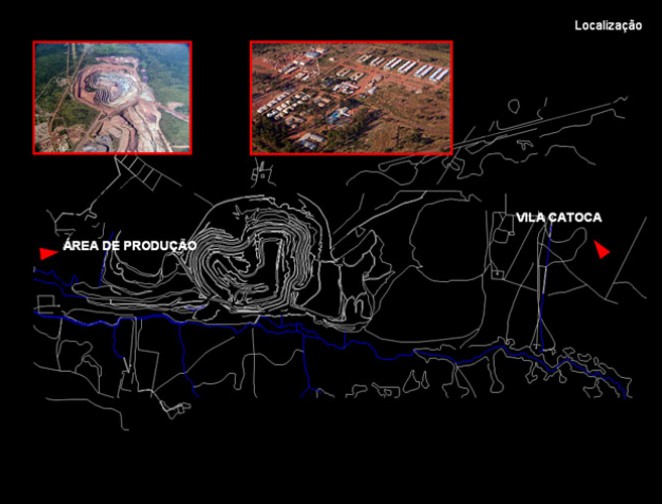
This plan was drawn up to the village of Catoca, in the province of Lunda Sul in Angola. The village was created by the Catoca Mining Society to support the mine and its workers, who are the target audience of this study.
The main strategic objective of this plan was the reorganization of the village in the sense of its sustainability, taking as starting point the existing village. We sought to define a new articulation of the urban network, intervening at the level of the road network, the block, the built and green areas, a formulation of a new macro system. It sets out a multifunctional and heterogeneous intervention strategy in four stages that aimed the sustainability of the village. These phases were planned to apply between 2008 and 2012, according to the priorities established in the identified weaknesses: the restructuring and hierarchy of the road and pedestrian network; the introducing of anchor projects as "handles" for the development of the town; the growth of the village in the South; the creation of new blocks and redefinition of existing ones; the appreciation of multifunctionality in detriment to the existing mono-functional zoning; and the introduction of a green structure connected to leisure and recreation activities and to function as "barrier structure" for dust and noise coming from the extraction and production zone. It was intended to establish an overall picture of modernity, creating a village with light, space, tree planting, as well as a new urban architecture revaluing and redefining existing buildings and connecting them through highways and perspectives, taking into account a fluid movement within the village. We studied an area for airport services aiming to the extension of the runway. The aim is, likewise, organize trade functions and services, sporting, recreational and leisure areas around the housing cells avoiding the mixture and complementary functions the dormitory areas and advocating the introduction of planning indicators to measure and monitor the sustainability of the territory and its evolution over time.